 In late February, we spent several boating trips conducting visual surveys of the sloughs (pronounced, “slews”), associated with the lower Apalachicola, Brothers and Chipola Rivers. These included Douglas Slough and Spider Cut. According to FWC, there are over 400 miles of sloughs, streams and lakes in the floodplain of the Apalachicola River.

Floodplains are extremely important to the health of river systems. Streams, sloughs, ponds, lakes, and swamps in the Apalachicola floodplain are alternately connected and disconnected from the main river channel as river flow fluctuates. The system of sloughs and backwater swamps help hydrate the floodplain and carry healthy, life-sustaining nutrients and detritus to the Bay.
As explained by knowledgable researchers, floodplains provide storage and filtration of surface water, diverse habitats for plants and animals, corridors for the movements of animals and dissemination of plants, and a supply of nutrients to bays and marine environments (Light et al, 1993).
The main river channel is connected to the floodplain by sloughs that cut thru a natural levee that forms as the river overtops its banks, slows down and drops sediments out. Looking at a cross-section of that area of floodplain shows typical elevations across the floodplain with the natural levee and sloughs connecting the lower backwater swamps. 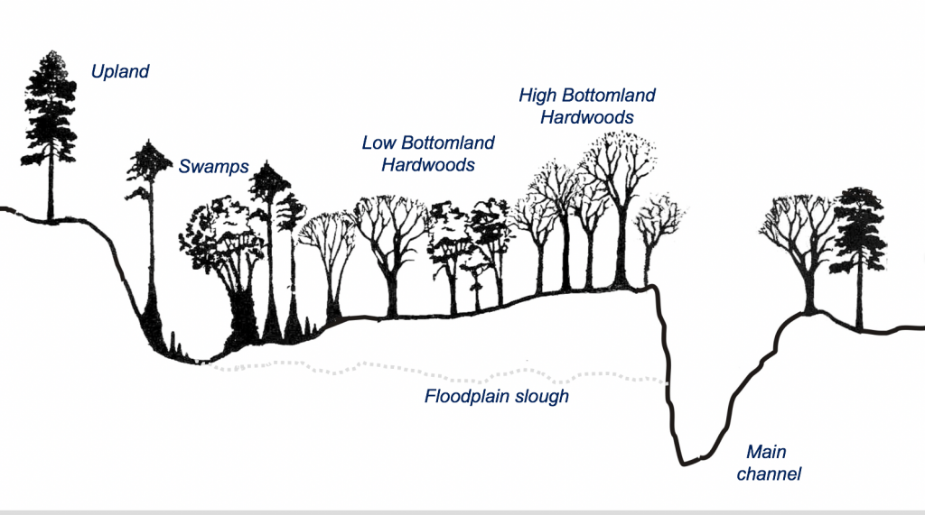
Full gallery of slough trip photos HERE.

Blog by Georgia Ackerman, Riverkeeper and Executive Director
Light, H. M., Darst, M. R ., MacLaughlin, M.T., and Sprecher S. W. (1993). Hydrology, Vegetation, and Soils of Four North Florida River Flood Plains with an Evaluation of State and Federal Wetland Determinations, Florida. United States Geological Survey Investigation Report 93-4033.