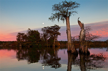
The Apalachicola River Basin and Apalachicola Bay comprises one of the most ecologically diverse natural areas in the southern United States. It has a significant variety of species of plants and animals, many of which are rare, many of which are found only in this area, and some of which are designated Threatened or Endangered. The Apalachicola River flows from the confluence of the Flint and Chattahoochee rivers at the Georgia-Florida border, where those rivers join to form Lake Seminole behind the Jim Woodruff Dam. From there the River travels 107 miles through the high bluffs of Grand Ridge and Cody Scarp to the Gulf coastal lowlands. The largest flow of any river in Florida then reaches Apalachicola Bay creating a rich estuary. This mostly-undeveloped basin supports a multi-billion dollar seafood industry in the Gulf of Mexico.
Apalachicola Bay is widely recognized as an exceptionally valuable estuarine system, one of the most outstanding remaining in the Northern Hemisphere. This River and Bay System is truly an American treasure—unique and matchless in aquatic and land species. An estuary is a partly-enclosed body of water where freshwater from rivers and streams meets and mixes with salt water from the ocean. Many different habitats are found in and around estuaries, including shallow open waters, freshwater and salt marshes, swamps, sandy beaches, oyster reefs, tidal pools, and seagrasses. This entire magnificent River-Bay system is being threatened on multiple fronts.
