By John Tracy
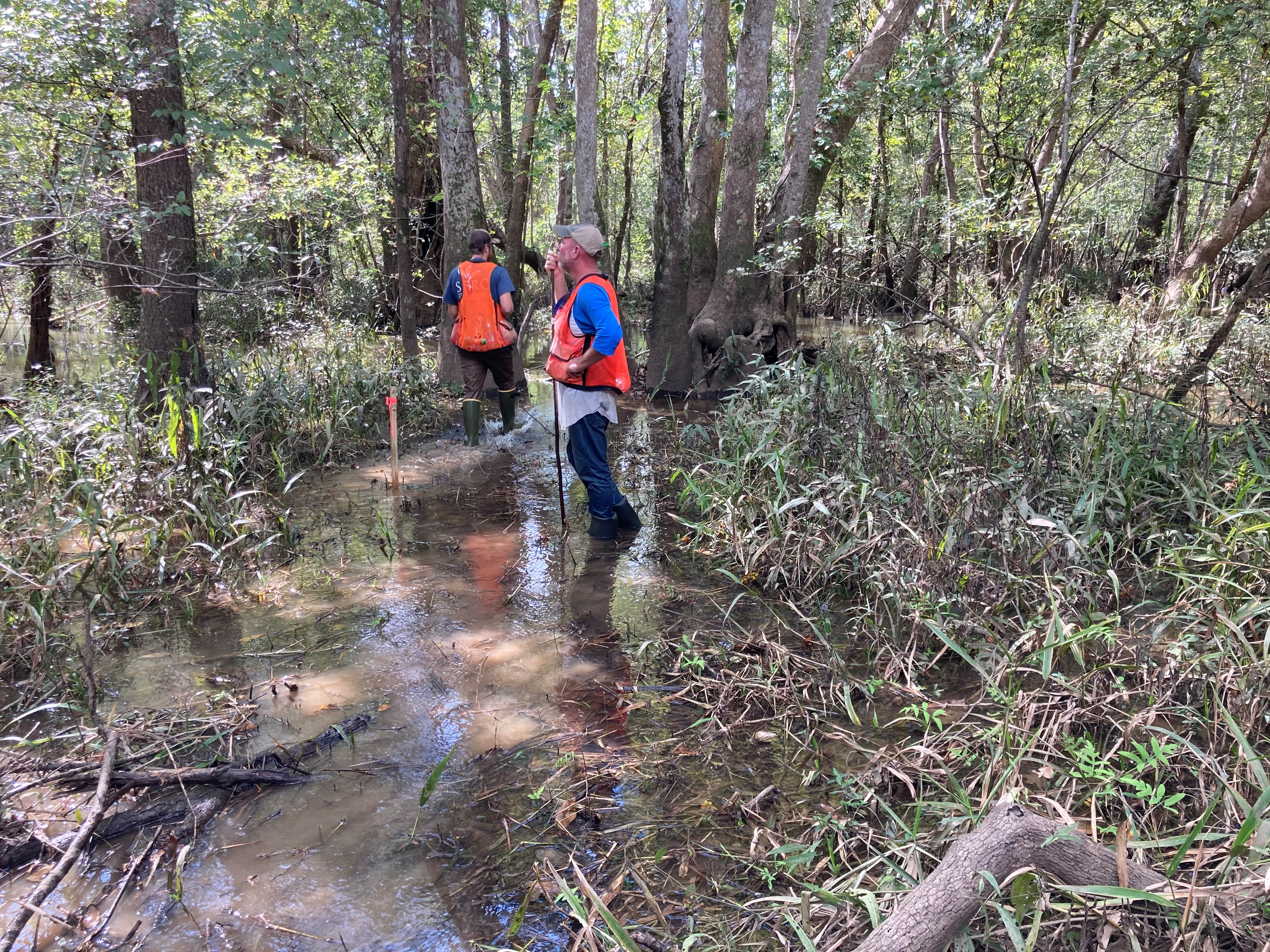
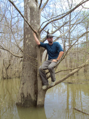
We made our second trip to Spider’s Cut during the week of October 19. On the previous trip, we familiarized ourselves with the area and met other team members. This second trip lasted three days in which we traversed the length of Spider’s Cut on foot and determined where our perpendicular transect lines to the slough channel would be located. A transect line is a predetermined distance across a habitat or ecosystem from which data can be collected and then returned to for future collection. In simpler terms, a transect line is a trail we will create to get us to and from our data collection sites.
We also began clearing and mapping the first two transect lines, which involved wading across belly deep creeks and bottoms, as well as mucking through wetland grasses while clearing vines and brush with machetes and clippers. We plan to return next week to continue placement of three more transect lines.
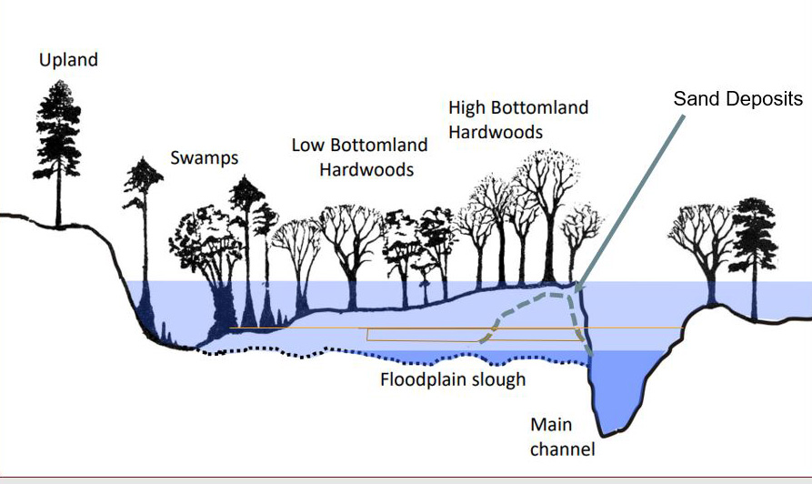
Along each transect line, five long-term vegetation and hydrologic monitoring plots will be established to analyze changes in overstory and
understory forest cover as they relate to changes in water depth. Data will be gathered prior to and after slough flow restoration of Spider’s Cut and Douglas Slough. I am working on additional projects to re-create previous studies in the floodplain that estimated changes in forest composition during the 1980’s and mid-2000’s. I will also be utilizing Forest Inventory and Analysis (FIA) data from the US forest Service within the floodplain to assess any changes in species composition over the past 50+ years that can be related to man-made changes in flow of the river including construction of dams upstream and dredging of the main channel.
John Tracy, MS is a Ph.D. student and Graduate Assistant at the University of Florida working with Dr. Ajay Sharma.
![]() By Scott Walls
By Scott Walls
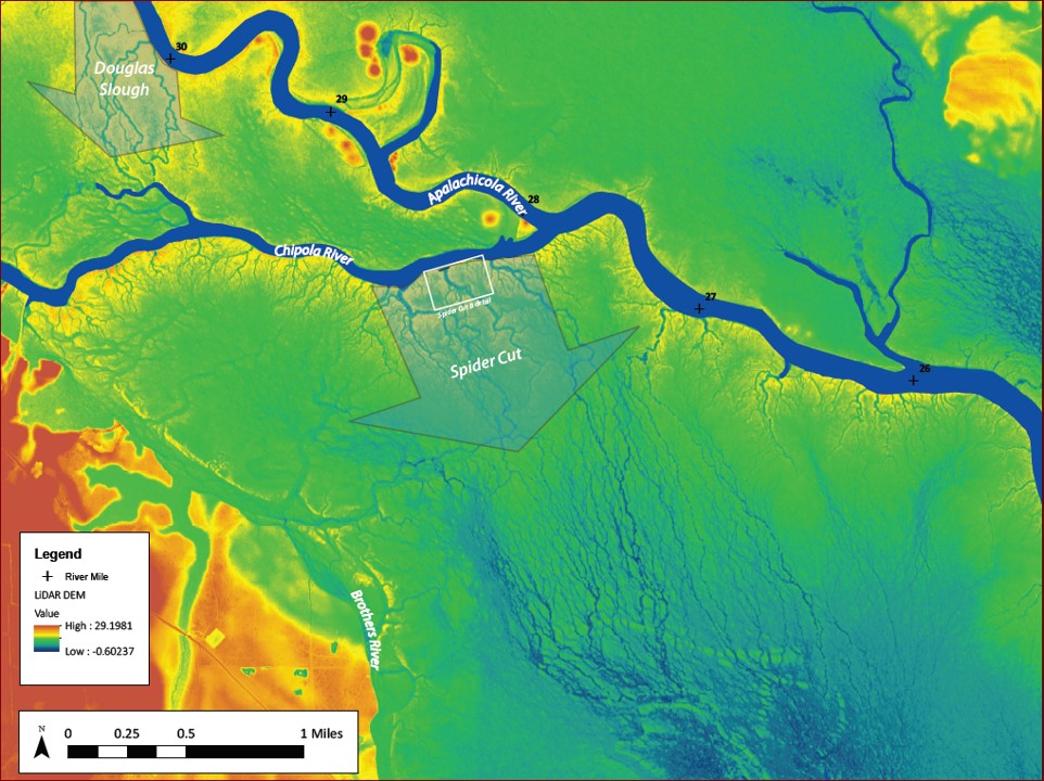
Our October field work focused Spiders Cut, a network of sloughs that brings water from the Chipola River across the floodplain and into the Brothers River. Elevations were established using GPS survey equipment and we used a total station (topographic survey equipment) to develop a network of over 40 control points along over a mile of Spiders Cut. These control points can be used to reference precise location and elevation along the channel for topographic surveying, monitoring equipment installation (water elevation, groundwater monitoring wells, water quality such as temp, dissolve oxygen and so on) and vegetation transects.
We also used the total station to survey detailed topography of the channel banks and channel bottom. This helps to locate and quantify volumes of sand to be removed to restore low flows. Higher than seasonal average water levels turned a topographic survey into a bathymetric survey requiring a boat, kayak, and best of all wading and swimming!
Scott Walls is a hydrologist and environmental planner. His expertise includes scientific data collection and analysis, planning, design, project implementation, and monitoring.
The project is funded by the National Fish and Wildlife Foundation, Gulf Environmental Benefit Fund.