9-25-2020–A visual survey from Chattahoochee to Apalachicola was conducted today. Boat ramps and sites in Chattahoochee, Bristol, Blountstown and Wewahitchka were visited. Water samples were also taken at several locations. Here are some photos. 
Special thanks to Macie Codina, FSU law student, for running the water sampling at Chattahoochee. 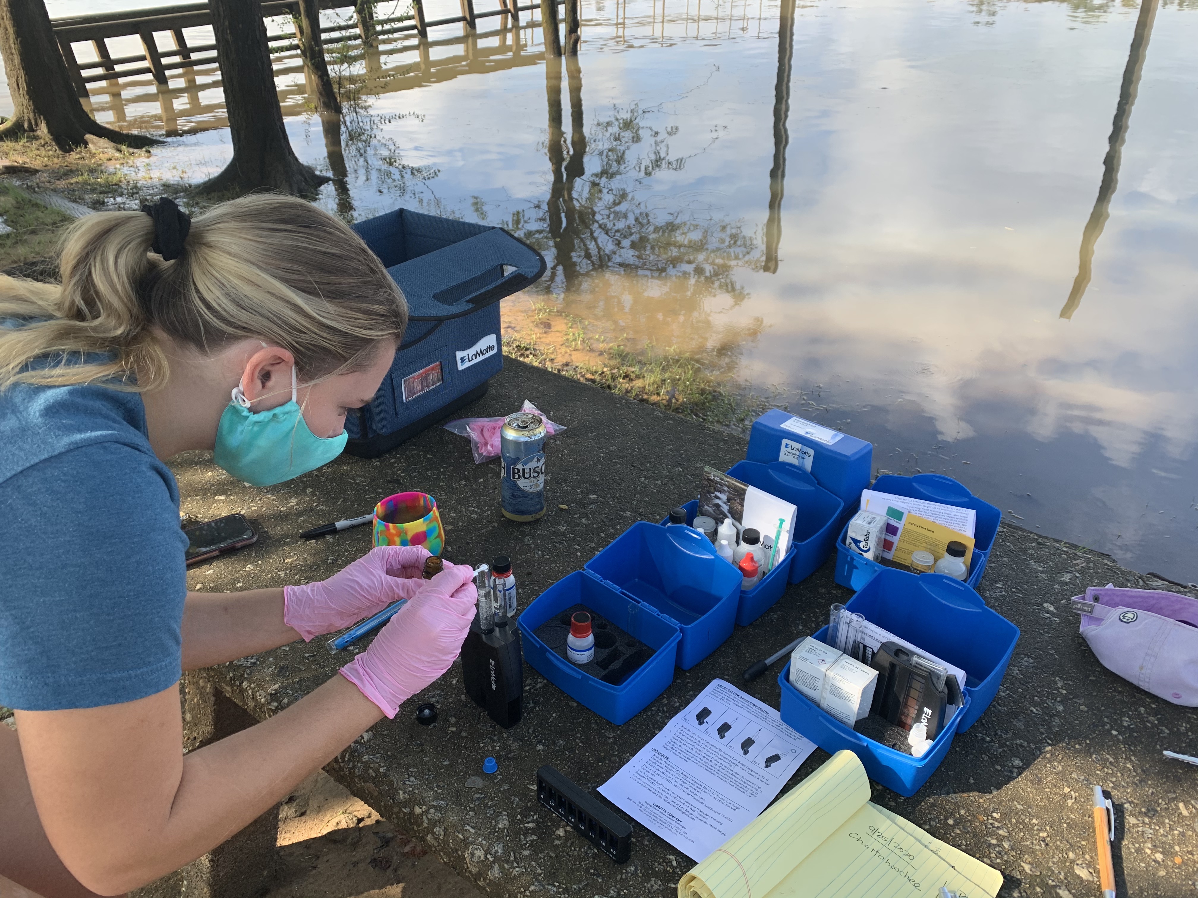
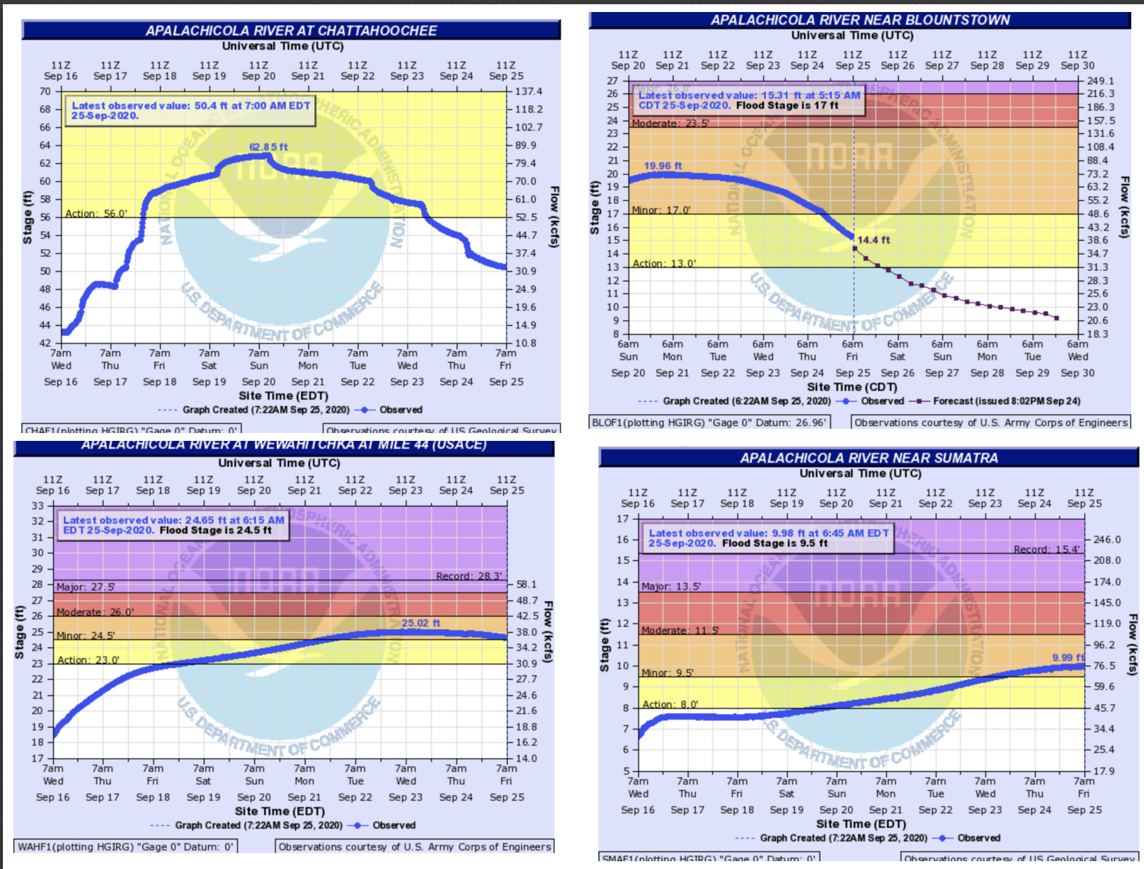
River flows increased after Hurricane Sally moved slowly across the Florida Panhandle with significant rainfall and coastal storm surge before making landfall near Gulf Shores, Alabama on September 16. The storm system then headed northeast towards the Carolinas. Rainfall in the northern ACF Basin also brought more water to the Apalachicola River as the USACE releases water from upstream reservoirs.
Of note, the Atlantic hurricane season has produced so many named storms that scientists ran out of traditional names after Tropical Storm Wilfred developed in the eastern Atlantic. Warming seas related to climate change are intensifying storms.
Resources
Auburn University’s Water Resource Center provides updated information on the climate, water, and drought status of the Apalachicola-Chattahoochee-Flint (ACF) River Basin. Here’s the September 2020 webinar.
 Posted by Georgia Ackerman, Riverkeeper & Executive Director