
By Doug Alderson, Apalachicola Riverkeeper Outreach & Advocacy Director
Skeletal husks of giant cypress trunks greet us as we paddle into the upper Dead Lakes a few miles above Wewahitchka. It is winter, so it’s not always easy to tell which trees are alive or dead since cypress can live to be hundreds of years old and can often be hollow and twisted by countless storms. A half hour before, we had launched at the Cypress Creek boat ramp, a little known access point 9 miles north of Wewahitchka. That is part of the appeal of this area. Despite there being a few houses along Cypress Creek, there are no visible houses along this part of the Dead Lakes. That’s because we are essentially paddling through a cypress swamp that happens to have the Chipola River flowing through it. Hundreds of years ago, a naturally occurring sandbar where the Chipola meets the Apalachicola River began to back up water, eventually killing thousands of trees. In 1960, a man-made dam was put in near Wewahitchka to finish the job, although the dam was later removed.
The only other people we meet on the water on this Monday morning are a couple of anglers. One is from California. “This place is beautiful,” he said with animation. “Come here in another month and everything will start blooming and leafing out.” He said they often catch bass, bream and shellcracker in the Dead Lakes and Cypress Creek.
In late April, the tupelo trees will start to bloom, something that has made the region famous because of the tupelo honey derived from it. Most of the trees we see are cypress, tupelo and some black titi. There is an annual Tupelo Honey Festival in nearby Wewahitchka, the only one of its kind. This year, it is May 15th.
As we navigate through the Dead Lakes, I have a GPS unit and am careful to follow an aerial map. This upper Dead Lakes area is not as open as the swamp a few miles south. Side passages shoot off in different directions and most will either hook back around to the main river channel or peter out. Some junctions are marked with a beer can stuck on a branch or a rusted metal arrow, offering little help as to their meaning. I don’t want our small group to become lost and we don’t. We make a small loop and at the main channel, we paddle upstream to an ancient bleached cypress trunk. It is a good turn around point.
In May, we plan to have a Riverkeeper trip here, thus the reason for our scouting mission. We also have FSU student Tyler Osha with us. He is doing a fellowship with Apalachicola Riverkeeper to develop GIS story maps of different trails in the basin. Story maps are interactive maps with photos that will help viewers take a virtual journey, but there is nothing like getting out in person and seeing for oneself!
Here is a good aerial video of the lower Dead Lakes region.
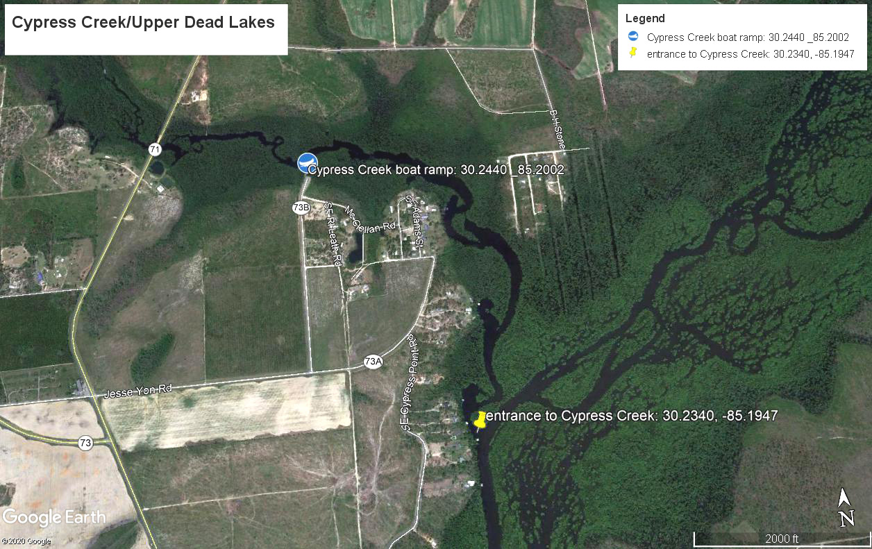
Aerial map of Cypress Creek and the upper Dead Lakes.
